RaDFire
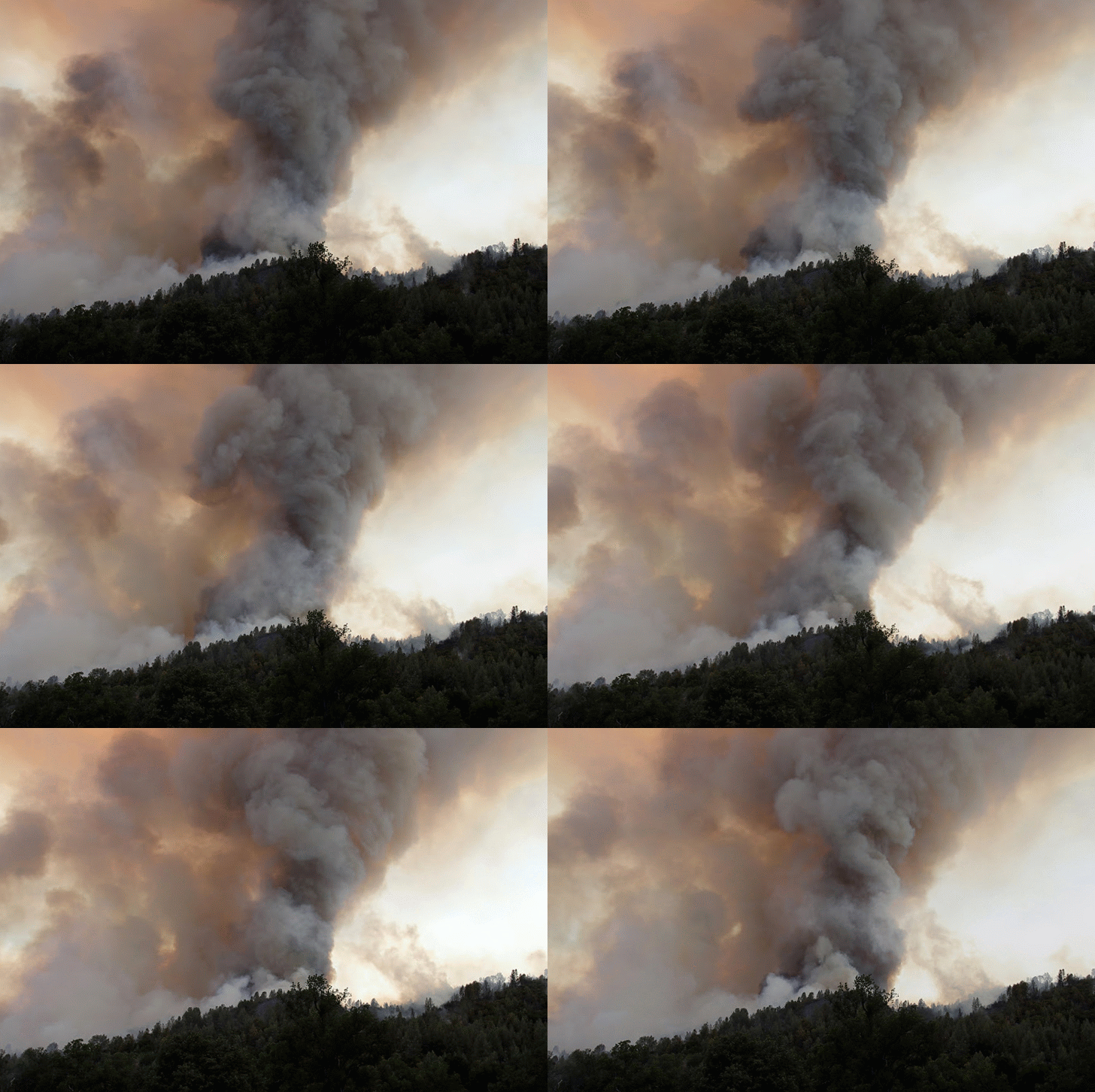
Crowning during the Stoney Fire at Fort Hunter Liggett (Photo: Richard Bagley)
Its been a busy and exciting month here at the Fire Weather Research Lab. As part of our Rapid Deployment to Fires (RaDFire) NSF project we've now deployed our mobile weather lab to 4 major fires in as many weeks: (1) Shirely Fire, Kern County, (2) Stoney Fire, Fort Huntter Liggett, (3) Butts Fire, Napa County, and (4) Bully Fire, Shasta County. As a result we've managed to collect some unbelievable data and I thought I'd take a few minutes to share some of the highlights pertaining to two important fire process: Rotating Updrafts and Penetrative Convection.
Rotating Updraft:
The Stoney Fire provided unprecedented observations of a vigorously rotating convective column. Rotation in the wildfire environment affects both fire rate of spread (ROS) and firefighter safety. In fact, a similarly rotating plume injured a number of fire fighters on the Indians Fire in 2008, which occurred just a few miles to the north of Hunter Liggett. Despite its importance, relatively little is known about the dynamics of rotating plumes and fire whirls, making the observations that we collected on the Stoney Fire very exciting!
Anticyclonic rotating convective column.
The rotation that we observed began during an intense plume dominated fire making a run up a small ridgeline. The rapidly intensifying plume first created strong convergence, which drew air into the fire from all directions. As the fire reached the ridge a vigorous anticyclonic rotation began within the convergent flow, as apparent the animation to the right. The rotation subsequently intensified and persisted for ~30 minutes.
We were fortunately in an ideal location to complete numerous horizontal scans with the lidar through the base of the rotating column. A snapshot of that data is shown in the figure below, where the top panel shows the radial velocity and the bottom panel the backscatter from the smoke. Tornado aficionados will recognize the clear vortex signature in the radial velocity data, which is appears as a couplet of inbound and out bound velocities. In this case the flow is about 30 mph (15 m/s) in each direction, and the vortex core is about 100 m in diameter. The circulation, unlike that in most tornadoes, is clockwise (anticyclonic). The smoke backscatter data is also quite interesting, revealing inwardly spiraling bands of smoke and clear air that are being drawn into the plume. I've added some annotations to the figures to make it a bit easier to interpret.
Penetrative Convection:
Penetrative convection occurs when a plume punches through an inversion layer and ascends rapidly into the mid-troposphere. We've observed this process twice this summer, once on the Butts Fire (2 July) and once on the Bully Fire (12 July). The figures below show vertical slices through these plumes.
Butts Fire: The sequence of panels below shows the process of the fire plume punching through the marine inversion. The left panels indicate that the smoke is initially trapped beneath a shear layer (note the opposing wind directions). The right set of panels, acquired a few minutes later, shows the smoke column punching a hole in the inversion layer and rising rapidly into the clear air aloft, taking on the characteristic "mushroom" shape of rapidly ascending convection.
Bully Fire: An even more impressive example of this process was documented just a few days ago on the Bully Fire. The animation below captures two pulses of the fire plume as it punches through an inversion layer and explosively ascends to nearly 5000 m (16, 000 ft). On this day the mid-troposphere was quite unstable, which allowed the plume to reach such impressive depths. The animation also shows important dispersion processes as the smoke spreads laterally within the shear layer and aloft as the plume collapses.To our knowledge these are some of the first well resolved observations of a deep plume of this nature. Finally, it was also interesting to note that the plume briefly formed a small pyrocumulus cloud, apparent as the brighter white at the top of the column in the picture below. In the future we hope to get some observations of better developed pyrocumulus clouds.
Bully Fire plume animation from lidar backscatter
Tenuous pyrocumulus
These observations are just the tip of the iceberg (top of the plume?). We'll be busy for months analyzing the rest of the data that we've collected. At first glance, we are quite encouraged by the ability of the lidar to resolve important details of plume dynamics from as far away as 5 km!
We'd also like to take a moment to thank the agencies that have allowed us access to these fires including the Fort Hunter Liggett Fire Department, US Forest Service, and CalFire. We look forward to continuing to work towards an improved understanding of fire dynamics and hope to be able to share more of our information in real time with the fire managers and crews in the near future.
-Neil Lareau


